PackUBIEST - a GPS tracker for my backpack
This project is part of the PackCTRL project, and reading it first is a good idea.
If you read it, you know why I wanted to add some security to my backpack. Short version: the first one was robbed.
So I started the PackCTRL 2.0 project with the strong desire of adding some secruty features. After thinking about built-in tasers and siren alarms, I decided to develop a GPS tracker. Modest and safe.
PackUBIEST
The GPS tracker was named PackUBIEST based on ubi est?, which translates from latin to “where is it?” In it’s final version, it had 2 main features:
- SMS based communication system;
- GPRS real-time communication system;
Hardware
To build the tracking device, I needed a programmable device with SMS, GPRS, GPS and battery management capabilities. After some research, I discovered Linkit One, by Seeed Studio, an Arduino-like board with everything I needed in it.
The power for PackUBIEST was separated from the rest of the backpack power storage, but still shared its charger. I was composed by 2x 18650 cells a 5V charger. At first, it had also an induction charger, which was removed due to safety issues - it was getting too hot!
Everything was enclosed in a small 3D printed box, which I’d hide inside the internal modular panel of the PackCTRL.
With this configuration, I could get up to 3 days of GPS tracking before recharging the module again, and I could still use other PowerBANKs to boost the PackUBIEST duration.
SMS Communication
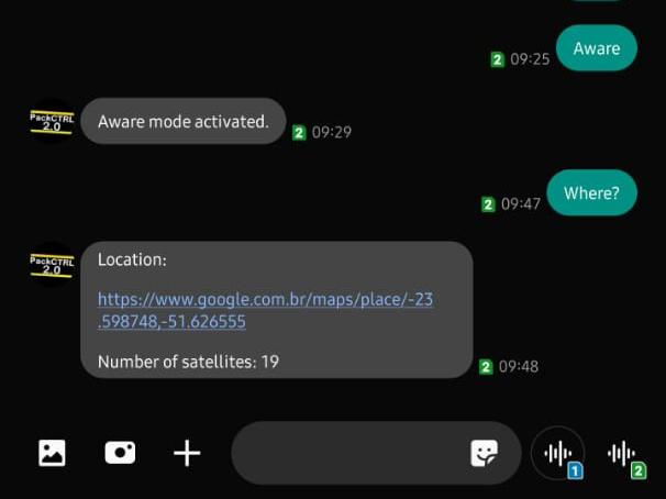
So the foundation of the communication system was based on SMS messages, as a reliable method. PackUBIEST would react to commands from a single authorized master number.
To become its master, one should send it the command Auth. The module would react, asking for the password. If it receives the correct password in the next minute, the new master is registered.
Being its master, there are a few commands available:
| Command | Response |
|---|---|
| Juice? | Battery left, in percentage. |
| Check | Tests connection to sattelites and answers the amount found |
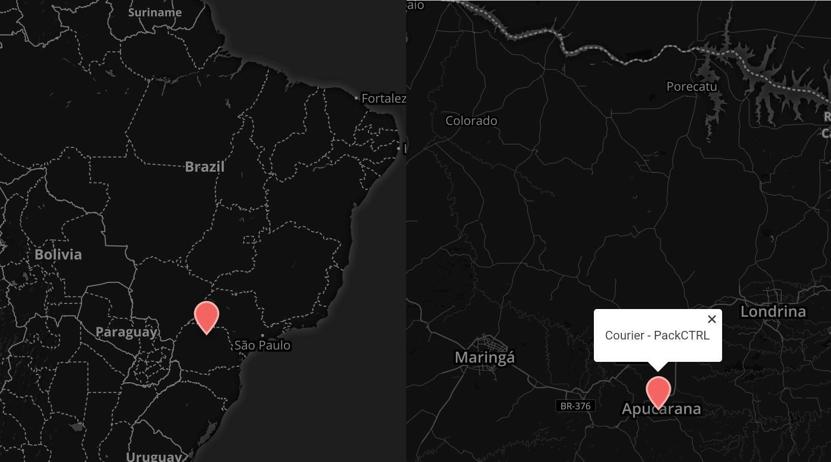
| Where? | Returns a link to Google Maps with a pin on the current location |
| Aware | Enters real-time mode |
| Deactivate | Exits real-time mode |
Real-Time Communication
The possibility to get a pin of the location of the backpack is a good feature, but it’s passive, meaning it would only tell the location upon request.I decided then to develop it further, so I created a new operation mode, that actively sends information to a live map.
The streaming was done through GPRS, which is more power-consuming and very unstable here in Brazil, so it was controlled by the basic SMS methods describe above, and if the connection was lost, it would fall back to normal, passive operation too.
The map consists of a simple HTML file with some javascript that would load the information from PubNub, a Data Streamn Network, and load it on a map provided by MapBox. The pin would be refreshed as soon as new information arrives, and clicking on it I was also able to see the current speed of the backpack.
Happily, I never needed to use it…